Overview
GIS is computing technology that helps understand spatial patterns and relationships by analyzing spatial data and using cartography techniques to present results in a variety of formats such as tables, graphs, and maps.
GIS makes sense of spatial information, whether it involve wildlife habitat, human health, climate change, or community land use.
Only available as a minor.
At a Glance
Curriculum
Why study GIS at Mount Allison?
At Mount Allison, the GIS program involves the study and application of computer models to represent features on the earth’s surface, map making (cartography), and the analysis of spatial patterns and relationships.
In the program, students learn how to use social research to track patterns of social vulnerability, public opinion, human activity, or to assess access to services.
In this interdisciplinary program, you'll look at subjects like:
- data collection and analysis
- cartography
- the role of maps in conveying geographic information
- research techniques
- advanced methods of producing and visualizing surfaces and data
GIS is available as a minor only.
Not sure about the difference between a major, a minor, an honours, and a certificate?
Program highlights
Experiential learning
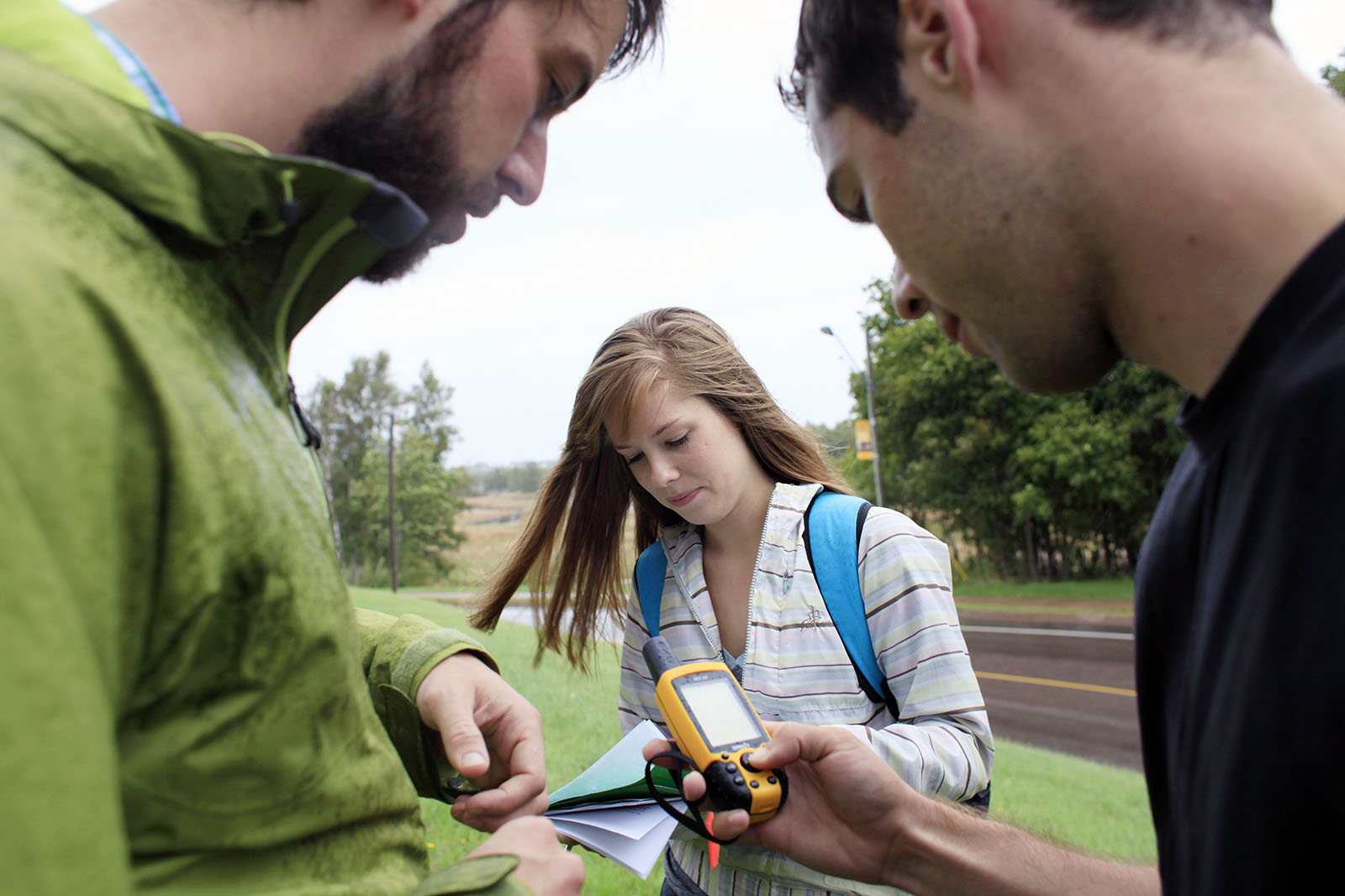
GIS students always spend time learning and collecting data in nature and in urban environments — including Sackville, around the Bay of Fundy, in communities throughout the Maritimes, and beyond.
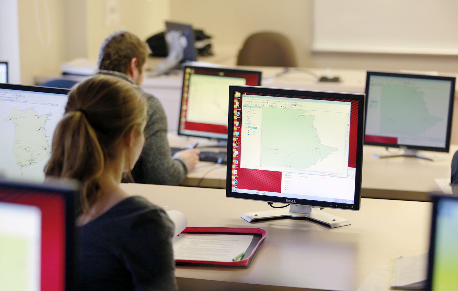
GIS Lab
Our geographic information systems (GIS) computing lab provides a teaching lab and research space for faculty and students. It supports a range of GIS software used by researchers and industry.
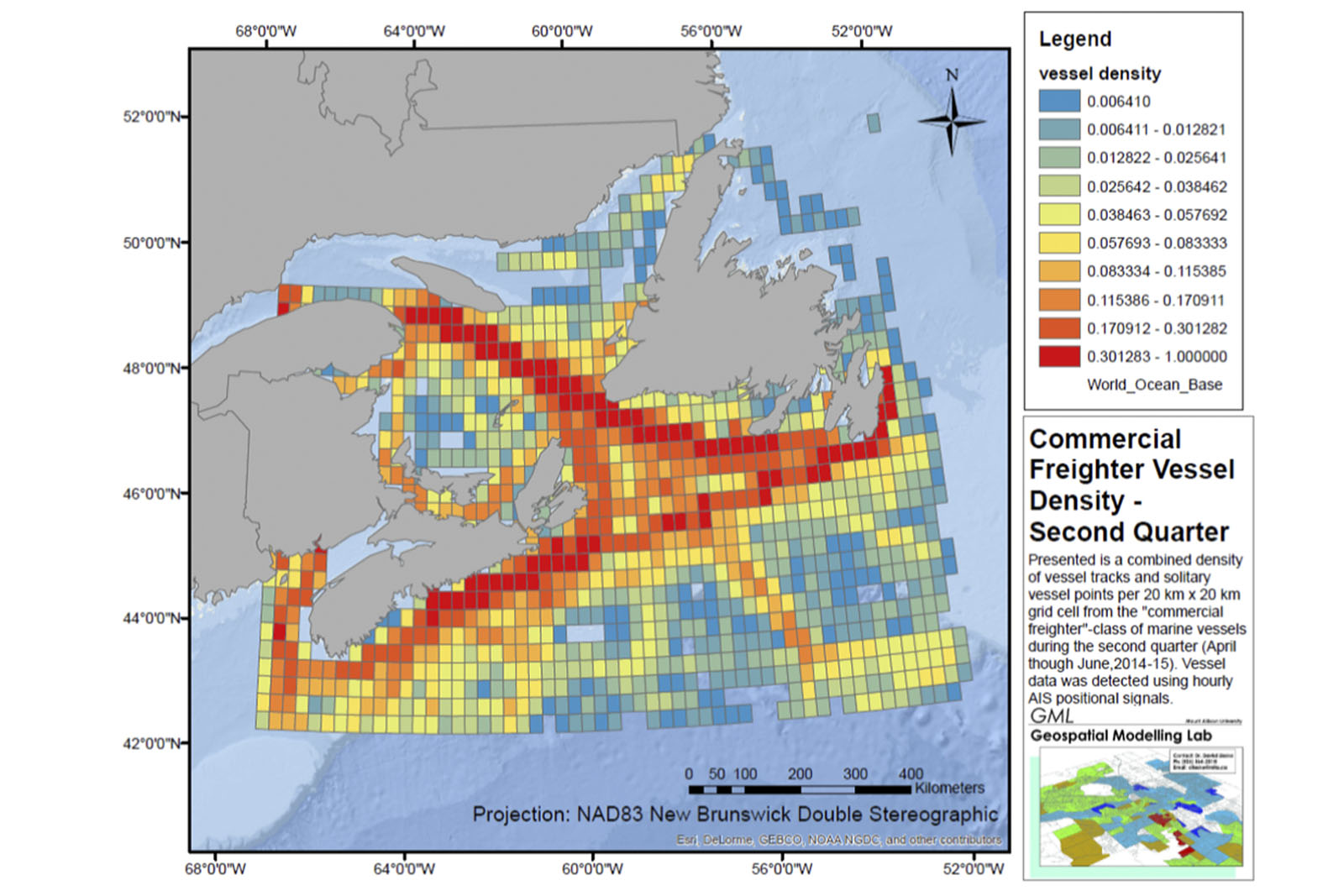
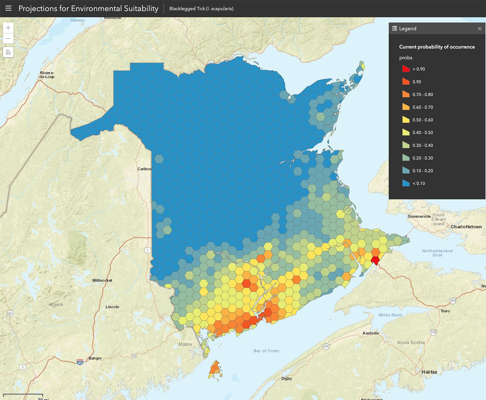
Geospatial Modelling Lab
The Geospatial Modelling Lab (GML) facilitates spatial analysis and modelling that can be applied to assist environmental monitoring, mapping and conservation planning.
Students have the opportunity to work in this lab as research assistants, particularly those minoring in GIS.
At Mount Allison, the core GIS courses are a mixture of lecture and lab where you have the opportunity to gain fluency in industry-leading software programs and GIS technology.
Combined with courses in computer science, as well as environment and geography, a GIS minor provides a valuable foundation in applied spatial analysis.
You'll learn the best practices of high-quality map-making, while in advanced classes you'll discover how to automate geoprocessing workflows and program GIS analyses using Python.
GENS 2441 — Geographic Information Systems
This course surveys several aspects of traditional cartography, examines one or more Geographic Information Systems, and explores the role of maps in conveying geographic information.
COMP 1631 — Introduction to Computer Science
This course provides a broad survey of computer science and an introduction to programming. Topics include: origins of computers, data representation and storage, Boolean algebra, digital logic gates, computer architecture, assemblers and compilers, operating systems, networks and the Internet, theories of computation, and artificial intelligence.
GENS 3401 — Research Methods in Environmental Science
This course begins with a critical examination of current research techniques. Students then design, implement, complete, and evaluate a field research project in environmental science. (Format: Lecture 3 Hours, Multi-Day Field Camp)
GENS 4721 — Advanced Geographic Information Systems
This course builds on the key concepts from GENS 2441 by introducing programming for automation and exploring advanced methods for producing and visualizing surfaces and data. It increases students' proficiency in the application of GIS and prepares them to conduct sophisticated spatial analyses.
Explore all Geography and Environment courses

Faculty Spotlight
Dr. David Lieske
Geography and Environment
» Researchers receive Environment and Climate Change Canada funding for microplastics study
What can I do with a GIS minor?
GIS has a wide relevance for solving problems in a number of fields, whether it involves wildlife habitat, public health, climate change, or community land use.
Recognized by Maclean’s as Canada’s top undergraduate university, Mount Allison’s strong academic reputation helps graduates stand out as they pursue diverse career paths.
Many go on to graduate studies in GIS, geography, and engineering, while others move directly into careers in GIS analysis, cartography, data science, and beyond.
Popular career paths for GIS graduates include:
- cartographer
- GIS/GPS analyst
- field surveyor
- computer mapping and software developer
- map interpreter
- image analysis using remote sensing products
- computer programmer
- database administrator
- spatial web/application developer
- consultant
Alumni Spotlight
Laura Salisbury ('13)
BSc, Environmental Science with minors in GIS and Biology
Geospatial Standards Advisor, Natural Resources Canada
"GIS will change how you approach and solve problems, allowing you to see issues from many different angles.”

What is it like to study at Mount Allison?
Studying GIS allowed me to do hands-on work in many different settings; in the computer lab I learned coding languages and data analysis while in the field I took samples and examined topics up close. Most importantly, GIS taught me how to see data distributions in the world around me, bringing the subject to life in nature, cities and stories.
/current-students/department-geography-and-environment
What are my admission requirements?
What other programs are related to GIS?
Geocomputing
Geocomputing is an applied program that combines theory and practice of computer science and geography.

Computer Science
Computer Science includes the analysis of algorithms, the study of computer architectures, operating systems, networks, and software design.

Geography
Geography is the study of places, exploring both the physical features of the earth and the relationship between people and their environments.